Micro siting and wind turbines
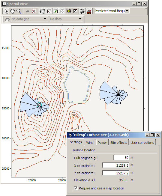
Given a regional wind climate and a digital map, the wind climate at any site and height in this map can be evaluated in a matter of seconds. A 'virtual' wind turbine site can be moved around in the terrain, either by dragging it with the mouse or by specifying its coordinates, and the wind climate and expected power production of these sites may be obtained. An example of a turbine site in a digital map is given below.
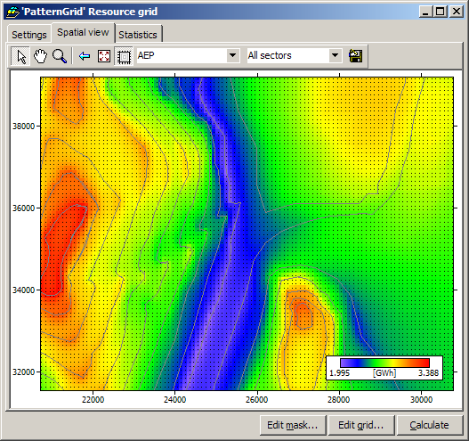
If you have a couple of minutes, or half an hour, you can also map the wind resource in detail over the site, say, with a resolution of 100 m. The value of the expected AEP is shown when you move the mouse slowly over the wind resource map: