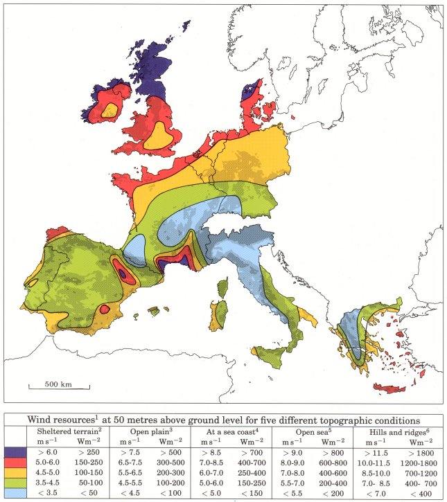
European Wind Atlas
The European Wind Atlas (1989) was a major outcome of the European Communities' overall effort to promote the market for electricity production from the wind resource in Europe and to develop the technologies and systems associated with it. It was the first attempt to provide comprehensive guidelines and statistics for the calculation of the wind energy resources of the European Community countries. DTU Wind (Risø National Laboratory) had the overall responsibility for project coordination and theoretical work, numerical modelling, data analysis, and reporting.
The Atlas is divided into three parts, each intended for readers with different areas of interest - from laymen to professional meteorologists.
Part I: The Wind Resource provides an overall view of the wind climate and magnitude and distribution of wind resources in the European Community countries.
Part II: Determining the Wind Resource gives explanations and information needed for the purpose of regional wind resource assessments and the local siting of wind turbines
Part III: The Models and the Analysis is the documentation part of the Atlas.
The Wind Atlas Methodology in general was first developed and described in detail for the European Wind Atlas. The wind Atlas Methodology makes it possible to transfer detailed information about the mean wind climate from one location (the predictor site) to another (the predicted site). The predictor site can be a meteorological station / wind-monitoring mast, or it can be a grid point in a mesoscale modelling domain. In the latter case, one may think of the model grid point as a virtual meteorological station. The predicted site often corresponds to the location and height of a specific wind turbine generator.

