In WAsP 12.7 we introduce forest displacement height assessed in wind flow calculations and applied in wind climate calculations.
When inserting a WAsP GML land cover map, which may include displacement heights, WAsP 12.7 uses an improved wind flow model to assess the sector-wise displacement heights at any site.
Subsequently, WAsP uses the improved wind flow model and applies the displacement heights in calculations of generalised wind climates as well as predicted wind climates.
We have decided to add this new feature to provide easy and correct forest displacement height modelling for WAsP users.
The improved wind flow model includes a) modifications to the roughness submodule and b) modifications to the orographic submodule.
Re. the roughness submodule:
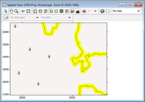
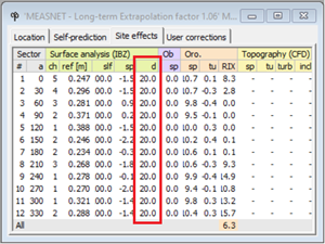
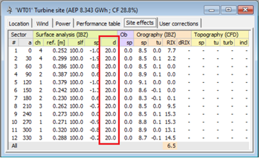
Previous versions of WAsP use an algorithm, which finds all crossings between the roughness change lines defined in a WAsP map and a number of rays extending from the point of interest. In WAsP 12.7 we also want to take into account the effect of displacement height, d. This information has to be passed from the land cover contour lines to the roughness model. So, instead of each line in the WAsP GML land cover map containing a left- and right roughness length, z0, the new routines expect the input of ’identifier’ lines, i.e. each line contains an identifier (ID), which represents a certain land cover left and right of the line. This ID is then represented in a land cover table, which prescribes the corresponding z0, d and a description of that land cover class.
A new spider grid analysis routine is developed to process WAsP GML land cover maps. It uses a polar zooming grid, similarly to the orographic flow model (Troen, 1990). For each cell in the zooming grid, the fraction of the total area fi that each of a total of N land cover types in the land cover table occupies is determined and the roughness length is calculated. The displacement height is taken into account similarly to z0 and is calculated for each cell in the zooming grid.
Re. the orographic submodule:
The submodule for orography computes speed-ups due to elevation, and WAsP uses the Bessel-expansion on a zooming grid (BZ) model (Troen, 1990). The input of the orographic model is a WAsP GML elevation map, which is processed into a polar zooming grid, with the highest resolution at the center point of the grid. The zooming grid of d obtained by using the spider grid analysis routine is added to the terrain elevation zooming grid. Using this grid, the methodology described in Troen (1990) is used to calculate sector-wise orographic speed-ups. In a forest, the introduction of a displacement height can cause orographic speed-ups to be different, although the input elevation data are the same.
For more information about the improved wind flow model, please refer to the paper “Satellite-based estimation of roughness lengths and displacement heights for wind resource modelling”[1].
WAsP 12.7 also includes a significantly updated help file as well as various bug fixes and performance enhancements.
WAsP Map Editor 12.4
This release includes WAsP Map Editor version 12.4, which makes it possible to create, edit, save and open WAsP GML land cover maps as well as WAsP GML elevation maps.
For more information please refer to the WAsP Map Editor help file, e.g. regarding “Manual Editing of Landcover description of a Landcover-area”.
You can download the WAsP suite installer and get the release notes here: https://www.wasp.dk/Download/WAsP12-Suite-Installer.
[1]
Rogier Floors, Merete Badger, Ib Troen, Kenneth Grogan, and Finn-Hendrik Permien: “Satellite-based estimation of roughness lengths and displacement heights for wind resource modelling”, Wind Energy Science, 6, 1379–1400, https://doi.org/10.5194/wes-6-1379-2021, 2021.